Aerial footage of Antarctica
Film on the Concordia station created by the Polar Institute using our images.
Aerials of Antarctica
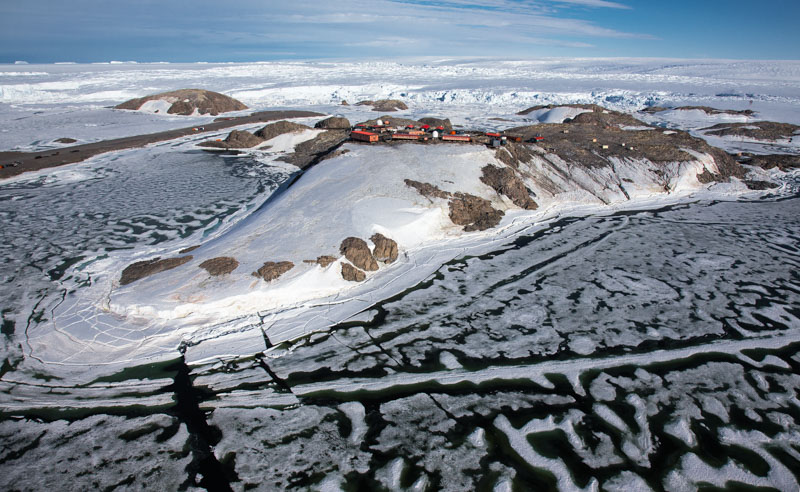
Documentation of the activities of the Dumont d'Urville and Concordia stations in drone and helicopter aerial images and ground images
In December 2018 and January 2019 in partnership with the IPEV, French Polar Institute, our director went to film in the Concordia and Dumont d'Urville stations in Antarctica.
Concordia, in the heart of the Antarctica continent, is one of the most isolated places in the world and one of the coldest. A handful of scientists and technicians work at the station throughout the year.
Concordia is a Franco-Italian polar research station located in Antarctica. The only European station in the heart of the Antarctic continent, its main purpose is to provide the scientific community with access to the Antarctic high plateau. The TGIR ("Very Large Research Infrastructure") also includes the logistical environment necessary to supply the station: the French Navy icebreaker l'Astrolabe, the annex station at Cap Prudhomme and the means of land transport. The specificities of the site give it a unique character:
- 3200m above sea level
- average air temperature at -50°C (-58°F)
- positioning under the track of polar orbiting satellites
- 3240mm ice thickness
- positioning under the polar vortex Concordia hosts 60 researchers and technicians in summer and 14 in winter. Nine months a year, the station is isolated from the rest of the world. The research conducted at Concordia reinforces observations of the planet on a vast continent that has only 3 indoor research stations. It enables unique research and observation programs to be carried out in many scientific and technological fields (glaciology, atmospheric physics and chemistry, astronomy, geophysics, etc.), many of which relate to climate change. It also houses studies supported by the European Space Agency (ESA) on medicine and human behavior in a confined environment. Beyond its scientific value, Concordia fulfills an important geopolitical role by strengthening the French and European presence in Antarctica and making it one of the main players in scientific research on the 6th continent.
Aerial images of Antarctica
Stock Footage of Antarctica shot in 2014, 2019 and 2023