Providence, Nassau and the Bahamas Bank
An aerial filming trip between Nassau, the Bahamas bank and its sandbars, the paradise islands of the Exumas.
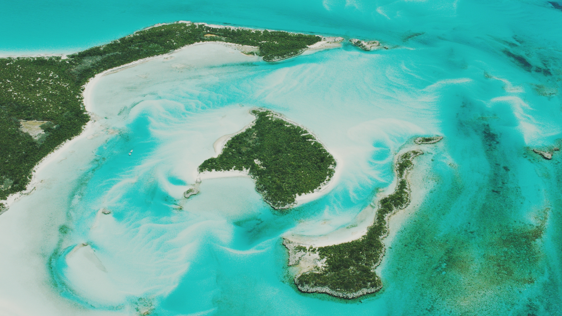
Picture flying over water so clear you can see the seabed twenty metres down, sandbars painting endless gradients of turquoise, and over 700 islands scattered like confetti across the Caribbean Sea. This is the Bahamas, one of the most photogenic aerial filming locations in the world.
Just an hour's flight from Miami, the Bahamas offer a striking contrast between the buzz of Nassau, its capital animated by cruise ships and luxury estates, and the absolute stillness of the deserted Exuma islands, home to swimming wild pigs and world-famous stingrays.
Nassau and Paradise Island — Home port to some of the world's largest cruise ships, Nassau blends colonial architecture, lively beaches and spectacular resorts. Seen from the air, the city reveals its contrasts : private marinas, casinos and historic districts side by side.
The Bimini Islands — The closest to the United States, just 83 km from Miami Beach, the Bimini Islands were long a favourite haunt of Ernest Hemingway and remain a renowned sport-fishing destination today.
Georgetown and the Exumas — The main town of the Exuma island chain, Georgetown is the gateway to one of the most beautiful strings of deserted islands in the Caribbean, where the water shifts from turquoise to deep blue within a few metres.
The sandbars — True natural sculptures shaped by ocean currents, the sandbars of the Bahamas emerge and vanish with the tides, creating striking abstract patterns of brilliant white against turquoise from above.
This footage was shot on an Arri Alexa, with a Cineflex Elite stabilisation system, for outstanding cinema-grade quality — around 7 hours of rushes available in our catalogue.
4K aerial stock footage of the Bahamas