
Aerial images taken 15 days after Typhoon Haiyan - Yolanda
Tacloban — The destruction of Typhoon Haiyan
Aerial footage shot fifteen days after Typhoon Haiyan struck the Philippines, November 2013
On 8 November 2013, the coasts of the Leyte region in the Philippines were struck by Typhoon Haiyan, known locally as Yolanda. Haiyan is considered one of the most violent typhoons ever recorded in meteorological history : sustained winds exceeding 300 km/h, gusts estimated at over 380 km/h, and above all a storm surge — a wall of water several metres high — that swept over the coasts of Leyte and obliterated the low-lying districts of Tacloban within minutes. The official death toll exceeds 6,000, but the true number of victims is estimated far higher — entire neighbourhoods were wiped from the map, taking their inhabitants with them.
Tacloban, a city of 220,000 inhabitants and the capital of Leyte province, was the epicentre of the disaster. The storm surge engulfed the city centre several kilometres inland, destroying thousands of homes, schools, hospitals and infrastructure. Satellite images taken after the typhoon showed an unrecognisable city — but it is from the air, aboard a helicopter, that the true scale of the destruction reveals itself in all its brutality.
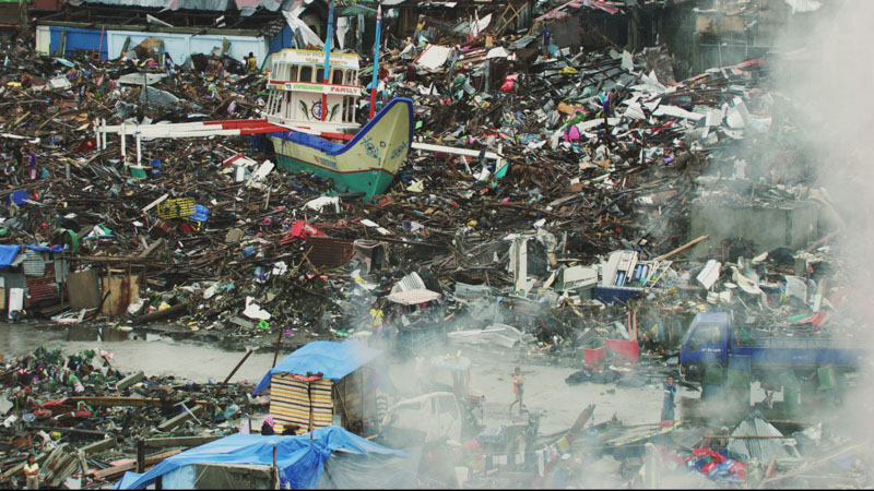
Aerial footage of Tacloban
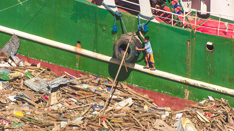
The shoot — Once international aid had been deployed and the area secured, our team boarded several observation flights, fifteen days after the typhoon struck, to film the devastated zone. Residents were only just beginning to organise themselves to clear the rubble — mountains of debris mixing timber, corrugated iron and everyday objects stretched for kilometres. From the air, the trajectories of the storm surge were still clearly visible in the urban fabric — corridors of total destruction cutting inland from the coastline, surrounded by areas spared by just a few metres of elevation.
This footage was shot using a gyro-stabilised Cineflex / Papa Sierra camera, aboard a helicopter provided by Philjet Aero Services.
Images Bruno Cusa / Stéphane Azouze — Music Pierre Cusa.
The shoot — Once international aid had been deployed and the area secured, our team boarded several observation flights, fifteen days after the typhoon struck, to film the devastated zone. Residents were only just beginning to organise themselves to clear the rubble — mountains of debris mixing timber, corrugated iron and everyday objects stretched for kilometres. From the air, the trajectories of the storm surge were still clearly visible in the urban fabric — corridors of total destruction cutting inland from the coastline, surrounded by areas spared by just a few metres of elevation.
This footage was shot using a gyro-stabilised Cineflex / Papa Sierra camera, aboard a helicopter provided by Philjet Aero Services.
Images Bruno Cusa / Stéphane Azouze — Music Pierre Cusa.